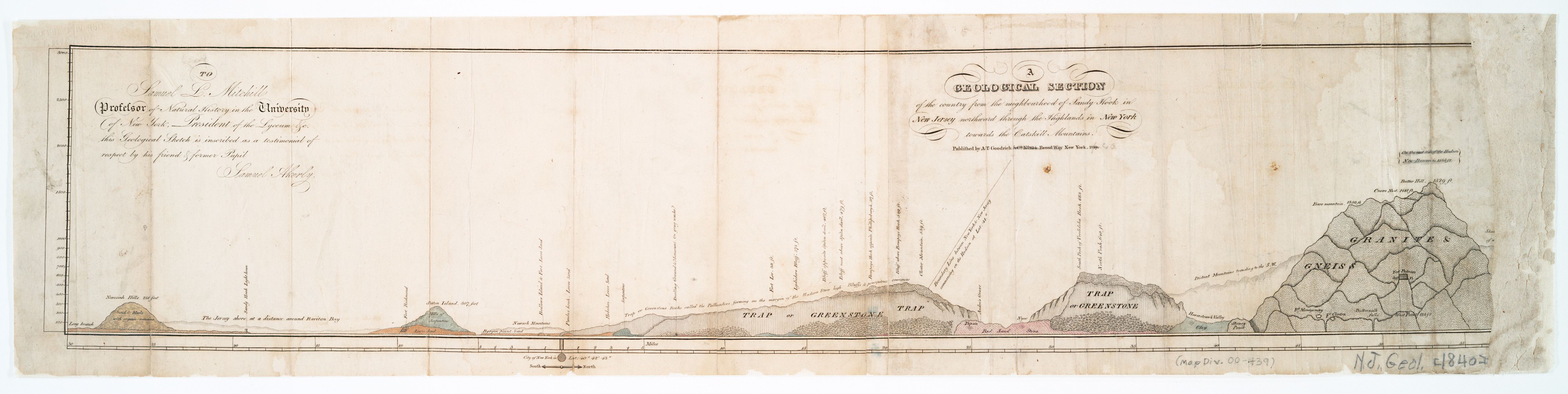
A Geological Section from Sandy Hook to the Catskill Mountains, 1820
1820
Sandy Hook to the Catskills · northern New Jersey to New York (general area)
The oldest known geological cross-section of northern New Jersey and the Hudson highlands, drawn by Samuel Akerly and inscribed to Samuel L. Mitchill, Professor of Natural History at the University of New York and President of the Lyceum. Read before the Lyceum of Natural History of New York in August 1819; published in 1820 by A. T. Goodrich & Co. of Broadway, Nassau, New York. The section runs left to right from Long Branch and the Never-sink Hills across Raritan Bay through the "trap or greenstone" of the Watchung Range, the Hudson, and the granite and gneiss of the Highlands and Catskills. The Never-sink Hills and the Palisades belong to the same trap-rock family — the earliest published statement of a fact this chapter also argues.
Item record
- Title
- A Geological Section from Sandy Hook to the Catskill Mountains, 1820
- Date
- 1820
- Source
- Samuel Akerly · published by A. T. Goodrich & Co., New York · 1820 · scan from the New York Public Library
- Contributor
- The New York Public Library
- Rights
- Public domain (published 1820)
- Slug
akerly-geological-section-1820
Verification: unverified.
Cite this item
A Geological Section from Sandy Hook to the Catskill Mountains, 1820 (1820). Samuel Akerly · published by A. T. Goodrich & Co., New York · 1820 · scan from the New York Public Library The Highlands History Project, https://history.abovethehook.com/archive/akerly-geological-section-1820/.