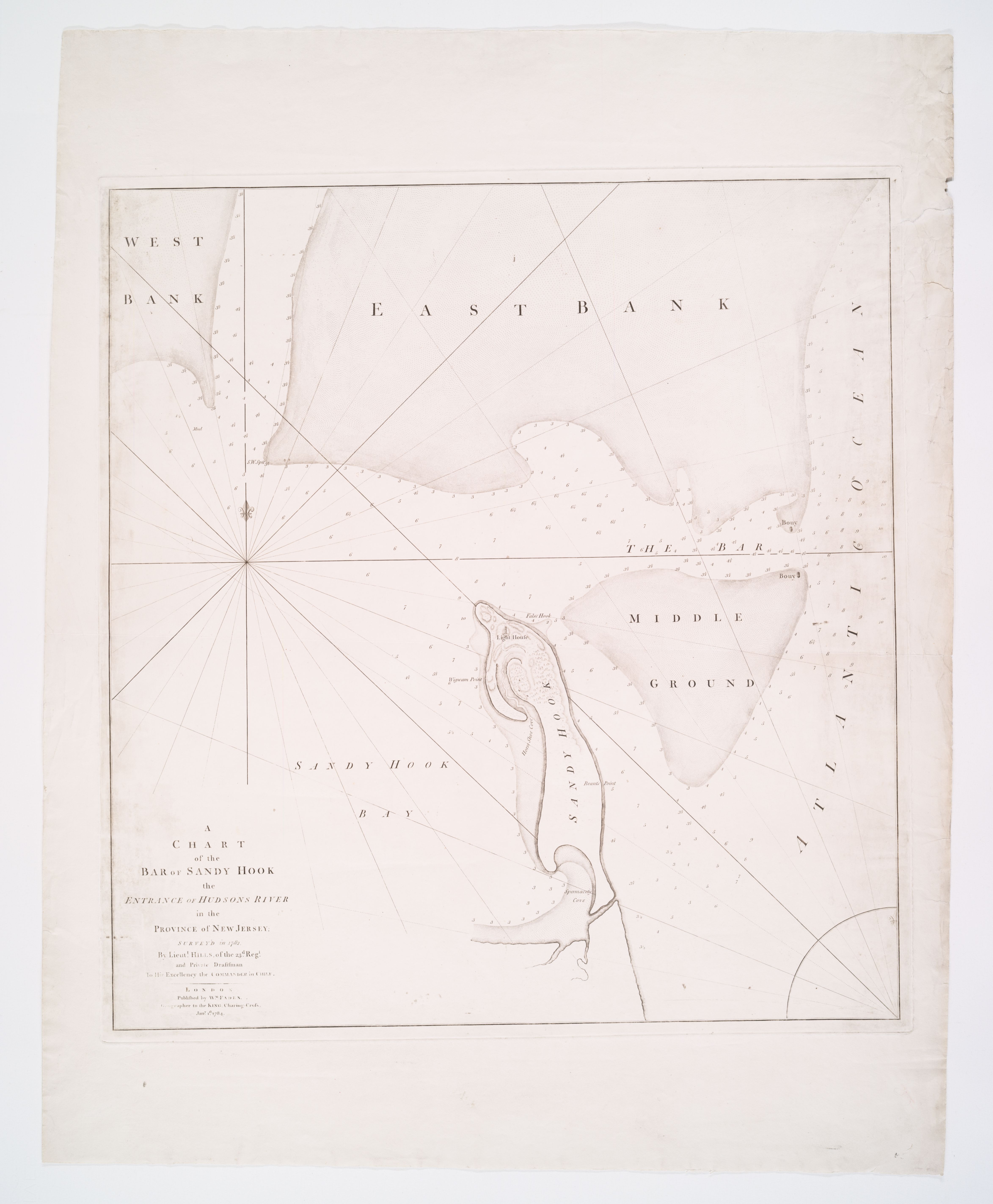
A Chart of the Bar of Sandy Hook, 1784
1782
Sandy Hook bar and approaches to New York Harbor (general area)
The bar and the bay as they were in 1782. Surveyed in 1782 by Lieutenant John Hills of the 23rd Regiment — a British engineering officer and private draftsman to the Commander in Chief during the final years of the war — and published in London in January 1784 by William Faden, Geographer to the King. West Bank, East Bank, and Middle Ground fill the top half of the sheet; the Sandy Hook Light House stands on a slim hooked peninsula at center, twenty years after first lighting. The Hook already curves; the tip has already walked away from the tower.
Item record
- Title
- A Chart of the Bar of Sandy Hook, 1784
- Date
- 1782
- Source
- Surveyed by Lieutenant John Hills, 23rd Regiment · published by William Faden, London · 1 January 1784 · scan from the New York Public Library, Lionel Pincus and Princess Firyal Map Division
- Contributor
- The New York Public Library · Lionel Pincus and Princess Firyal Map Division
- Rights
- Public domain (published 1784)
- Slug
faden-sandy-hook-bar-1784
Verification: unverified.
Cite this item
A Chart of the Bar of Sandy Hook, 1784 (1782). Surveyed by Lieutenant John Hills, 23rd Regiment · published by William Faden, London · 1 January 1784 · scan from the New York Public Library, Lionel Pincus and Princess Firyal Map Division The Highlands History Project, https://history.abovethehook.com/archive/faden-sandy-hook-bar-1784/.