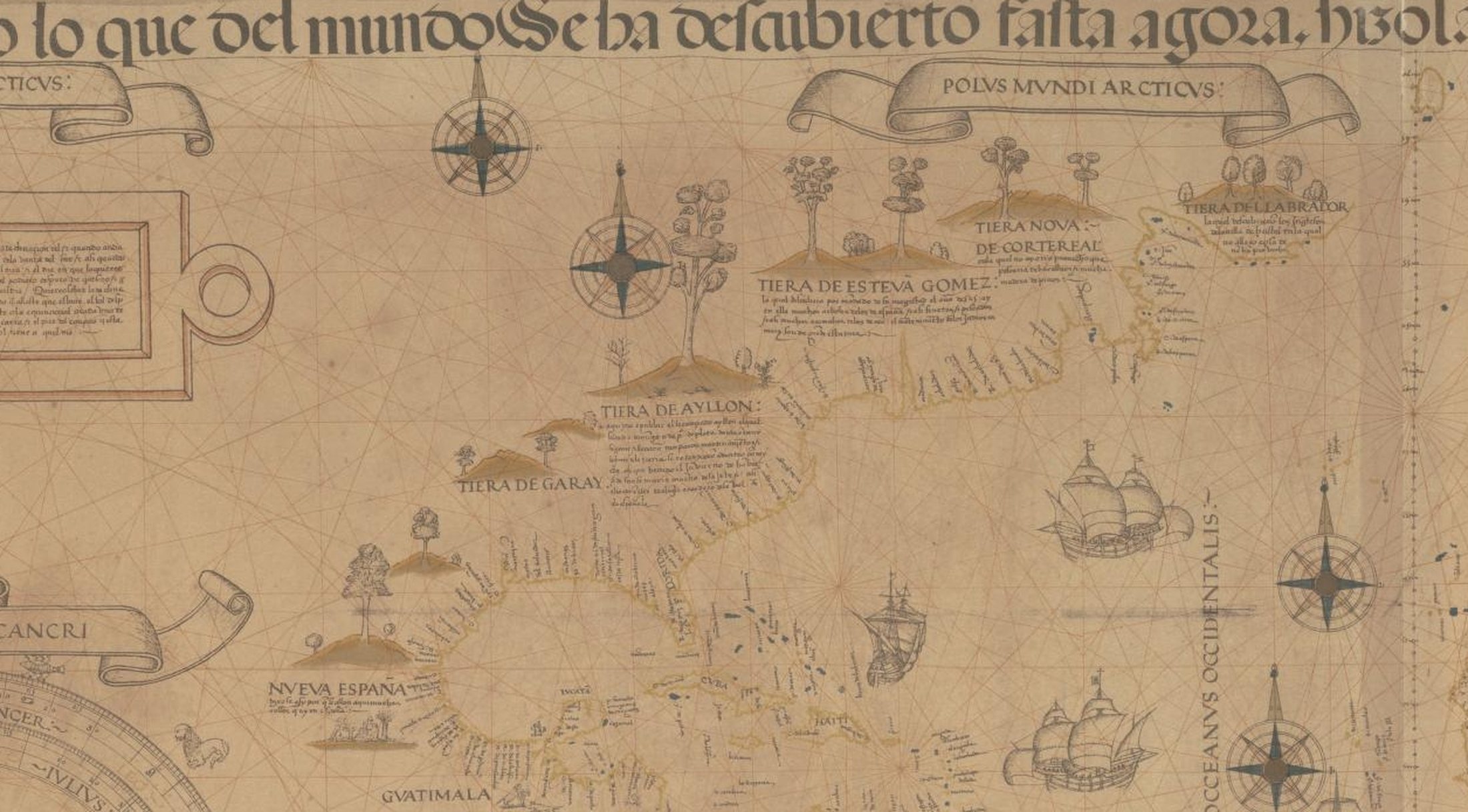
Tiera de Esteva Gomez on the Ribeiro planisphere, 1529
1529
The Atlantic seaboard as mapped in 1529 (approximate)
The North American Atlantic seaboard as European cartography first recorded it whole, on Diogo Ribeiro's world map of 1529 — incorporating Estêvão Gomes's survey of 1525. The coast runs unbroken from the Gulf to Labrador, and the stretch that includes this bay is lettered TIERA DE ESTEVA GOMEZ, the Land of Esteban Gómez, after the pilot who ran it and carried people off it. Reproduced from William Griggs's photo-lithograph of about 1887.
Item record
- Title
- Tiera de Esteva Gomez on the Ribeiro planisphere, 1529
- Date
- 1529
- Source
- Diogo Ribeiro, world map, 1529 (the Propaganda copy, Vatican City), in William Griggs's photo-lithographic reproduction of c. 1887 · National Library of Australia · public domain.
- Contributor
- National Library of Australia
- Rights
- Public domain. A c. 1887 reproduction of a 1529 original; both are long out of copyright.
- Slug
first-sails-ribeiro-1529-esteva-gomez
Verification: unverified.
Cite this item
Tiera de Esteva Gomez on the Ribeiro planisphere, 1529 (1529). Diogo Ribeiro, world map, 1529 (the Propaganda copy, Vatican City), in William Griggs's photo-lithographic reproduction of c. 1887 · National Library of Australia · public domain. The Highlands History Project, https://history.abovethehook.com/archive/first-sails-ribeiro-1529-esteva-gomez/.