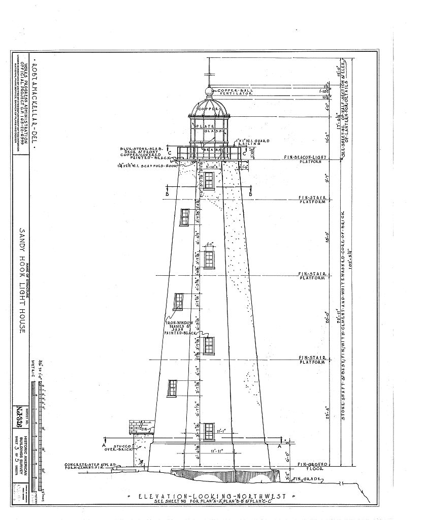
Sandy Hook Lighthouse — elevation looking northwest, HABS NJ-326 sheet 3, 1937
1937
Sandy Hook Lighthouse, north end of the peninsula
Robert A. MacKellar's measured elevation of the 1764 Sandy Hook Lighthouse, HABS NJ-326 sheet 3 of 5, drawn in 1937 under WPA Official Project 165-22-6-999. The full octagonal tower dimensioned in feet and inches — 103 feet from grade to the top of the vent ball, five window levels stepping up the taper, the lantern and copper-ball ventilator crowning the whole. The one document that makes Conro's 1764 arithmetic legible in a modern hand.
Item record
- Title
- Sandy Hook Lighthouse — elevation looking northwest, HABS NJ-326 sheet 3, 1937
- Date
- 1937
- Source
- Historic American Buildings Survey · Robert A. MacKellar, delineator · 1937 · Library of Congress (HABS NJ-326, sheet 3 of 5)
- Contributor
- Robert A. MacKellar · Historic American Buildings Survey (HABS NJ-326) · Library of Congress
- Rights
- Public domain (U.S. federal government work — Historic American Buildings Survey, Library of Congress)
- Slug
habs-sandy-hook-lighthouse-elevation-1937
Verification: unverified.
Cite this item
Sandy Hook Lighthouse — elevation looking northwest, HABS NJ-326 sheet 3, 1937 (1937). Historic American Buildings Survey · Robert A. MacKellar, delineator · 1937 · Library of Congress (HABS NJ-326, sheet 3 of 5) The Highlands History Project, https://history.abovethehook.com/archive/habs-sandy-hook-lighthouse-elevation-1937/.