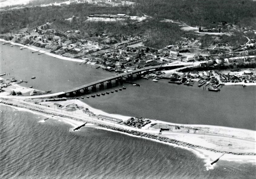
Aerial view of the Route 36 crossing to Sandy Hook, ca. 1948
ca. 1948
Highland Beach, foot of Sandy Hook (general area)
An aerial photograph looking east across the Route 36 high bridge as it crosses from the Highlands mainland onto the Sandy Hook peninsula, ca. 1948. The full Sandlass Beach Club — bathhouses, pavilion, and the family house that would later be renumbered Building 600 — sits on the south face of the peninsula at the foot of the bridge. Small craft cluster along the docks upper right. The Highlands village climbs the ridge in the upper left.
Item record
- Title
- Aerial view of the Route 36 crossing to Sandy Hook, ca. 1948
- Date
- ca. 1948
- Source
- Sandlass Family Collection · via ATH archive
- Contributor
- Sandlass Family Collection
- Rights
- Sandlass Family Collection — permission granted for ATH publication
- Slug
hb-family-img-8474
Verification: unverified.
Cite this item
Aerial view of the Route 36 crossing to Sandy Hook, ca. 1948 (ca. 1948). Sandlass Family Collection · via ATH archive The Highlands History Project, https://history.abovethehook.com/archive/hb-family-img-8474/.