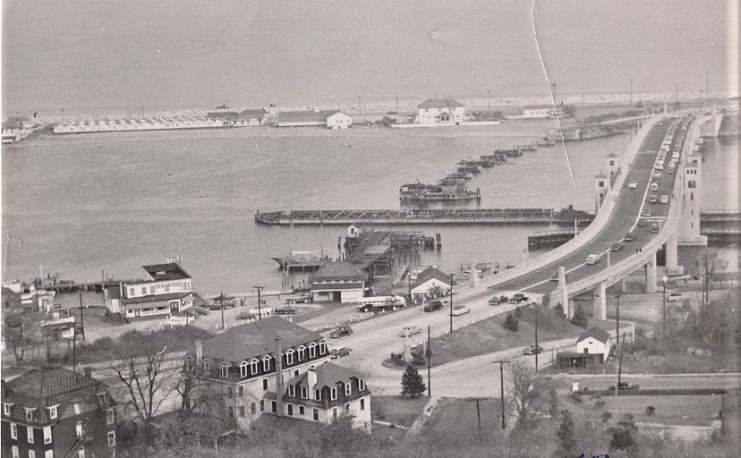
Bay Avenue and the Route 36 bridge from above, ca. 1950
ca. 1950
Highland Beach, foot of Sandy Hook (general area)
An elevated view of the Highlands waterfront looking east across Bay Avenue toward Sandy Hook, ca. 1950. The Route 36 high bridge climbs across the frame at right; the Sandlass Beach Club bathhouse row runs along the peninsula behind. Docks and small commercial buildings line the shore in the middle distance — the party-boat fleet's Bay Avenue home. Cottages and a Victorian mansard-roofed house cluster at the base of the ridge, foreground.
Item record
- Title
- Bay Avenue and the Route 36 bridge from above, ca. 1950
- Date
- ca. 1950
- Source
- Sandlass Family Collection · via ATH archive
- Contributor
- Sandlass Family Collection
- Rights
- Sandlass Family Collection — permission granted for ATH publication
- Slug
hb-family-img-8477
Verification: unverified.
Cite this item
Bay Avenue and the Route 36 bridge from above, ca. 1950 (ca. 1950). Sandlass Family Collection · via ATH archive The Highlands History Project, https://history.abovethehook.com/archive/hb-family-img-8477/.