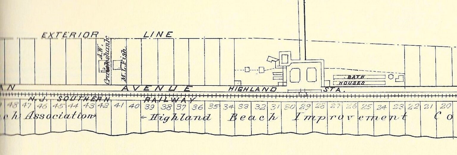
Plat map of Highland Beach lots 20–48, N.J. Southern Railway alignment
ca. 1893
Highland Beach, foot of Sandy Hook (general area)
A section of an original surveyor's plat map of Highland Beach showing numbered lots 20 through 48 (and the neighboring 49-plus range at left), the New Jersey Southern Railway right-of-way, Highland Beach Station, the bathhouse row, and the leaseholders' annotations. The label at the left half of the row reads HIGHLAND BEACH ASSOCIATION; the right half reads HIGHLAND BEACH IMPROVEMENT CO. Two individual leaseholders are named on adjacent lots — A. W. Crocker and M. L. Fish — recording the exact footprint of the Improvement Company's lease-to-individual model. The date is close to the 1893 lease that first placed William Sandlass on Lots 23–26.
Item record
- Title
- Plat map of Highland Beach lots 20–48, N.J. Southern Railway alignment
- Date
- ca. 1893
- Source
- Sandlass Family Collection · via ATH archive
- Contributor
- Sandlass Family Collection
- Rights
- Sandlass Family Collection — permission granted for ATH publication
- Slug
hb-family-img-8497
Verification: unverified.
Cite this item
Plat map of Highland Beach lots 20–48, N.J. Southern Railway alignment (ca. 1893). Sandlass Family Collection · via ATH archive The Highlands History Project, https://history.abovethehook.com/archive/hb-family-img-8497/.