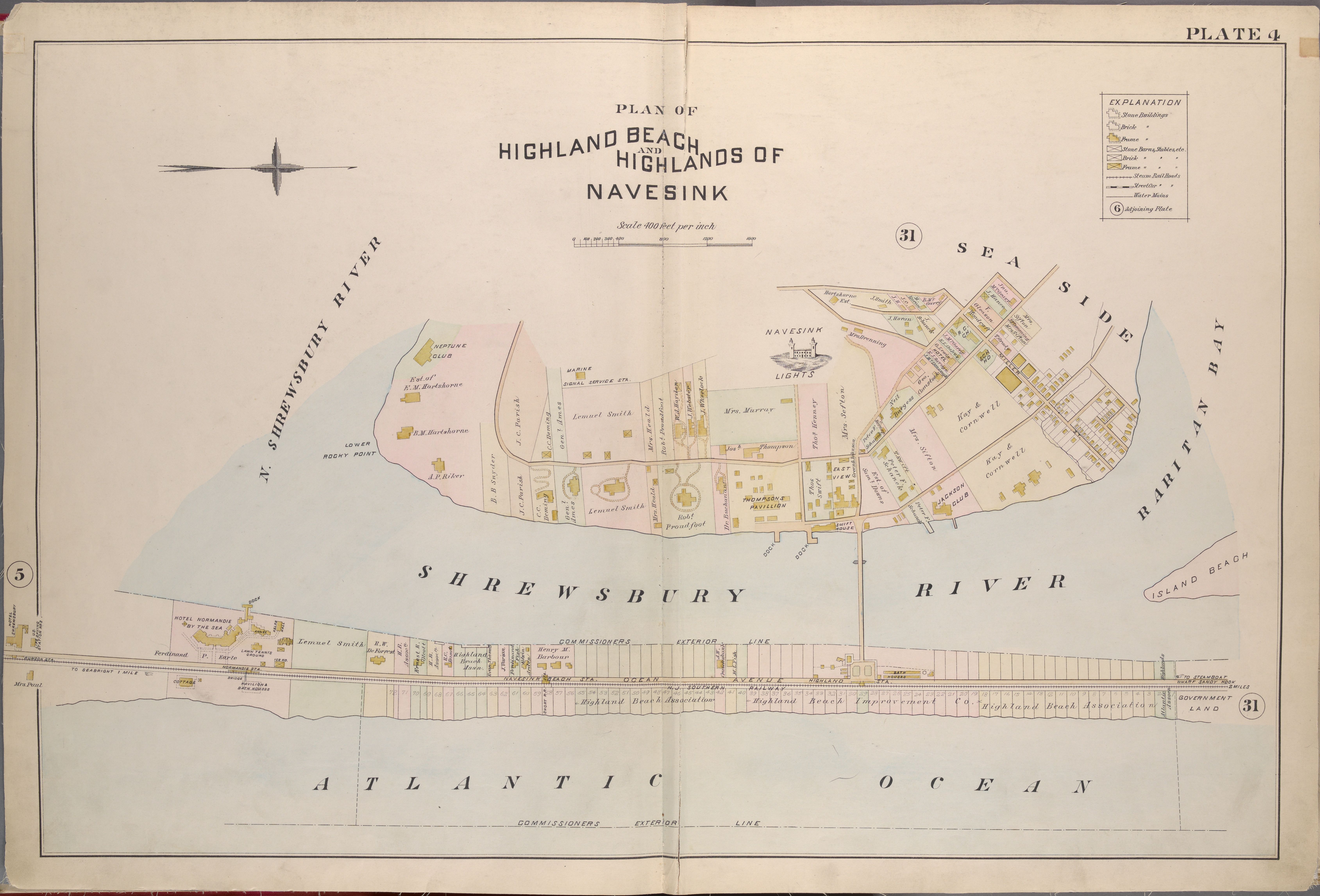
Plan of Highland Beach and Highlands of Navesink · atlas plate
ca. 1889
Highland Beach and the Highlands of Navesink (general area)
A property atlas plate at four hundred feet per inch — Highland Beach and the Highlands of Navesink drawn as a working municipal document. The Sandlass leasehold occupies the long strip of numbered lots along Ocean Avenue at the bottom of the plate, between the N.J. Southern Railway line and the Atlantic. The Hartshorne estate holds the ridge to the north; Neptune Club and Jackson Club and the "Marine Signal Service Sta." mark the older turn-of-century development. Individual landowners are named in small script across each parcel: Hartshorne, J. C. Parish, Lemuel Smith, Mrs. Murray, Robt. Proudfoot, Henry M. Barbour, Kay & Cornwell, and dozens more. The Navesink Lights stand at center-right on the ridge; the Hotel Normandie by the Sea sits at the west end of the beach strip; the Highland Beach Association and Highland Beach Improvement Company are named on the boardwalk lot line beneath. A snapshot of the resort at its peak.
Item record
- Title
- Plan of Highland Beach and Highlands of Navesink · atlas plate
- Date
- ca. 1889
- Source
- Late 19th-century property atlas of Monmouth County · scan from the New York Public Library
- Contributor
- The New York Public Library
- Rights
- Public domain (over 100 years old)
- Slug
highland-beach-plate-4-atlas
Verification: unverified.
Cite this item
Plan of Highland Beach and Highlands of Navesink · atlas plate (ca. 1889). Late 19th-century property atlas of Monmouth County · scan from the New York Public Library The Highlands History Project, https://history.abovethehook.com/archive/highland-beach-plate-4-atlas/.