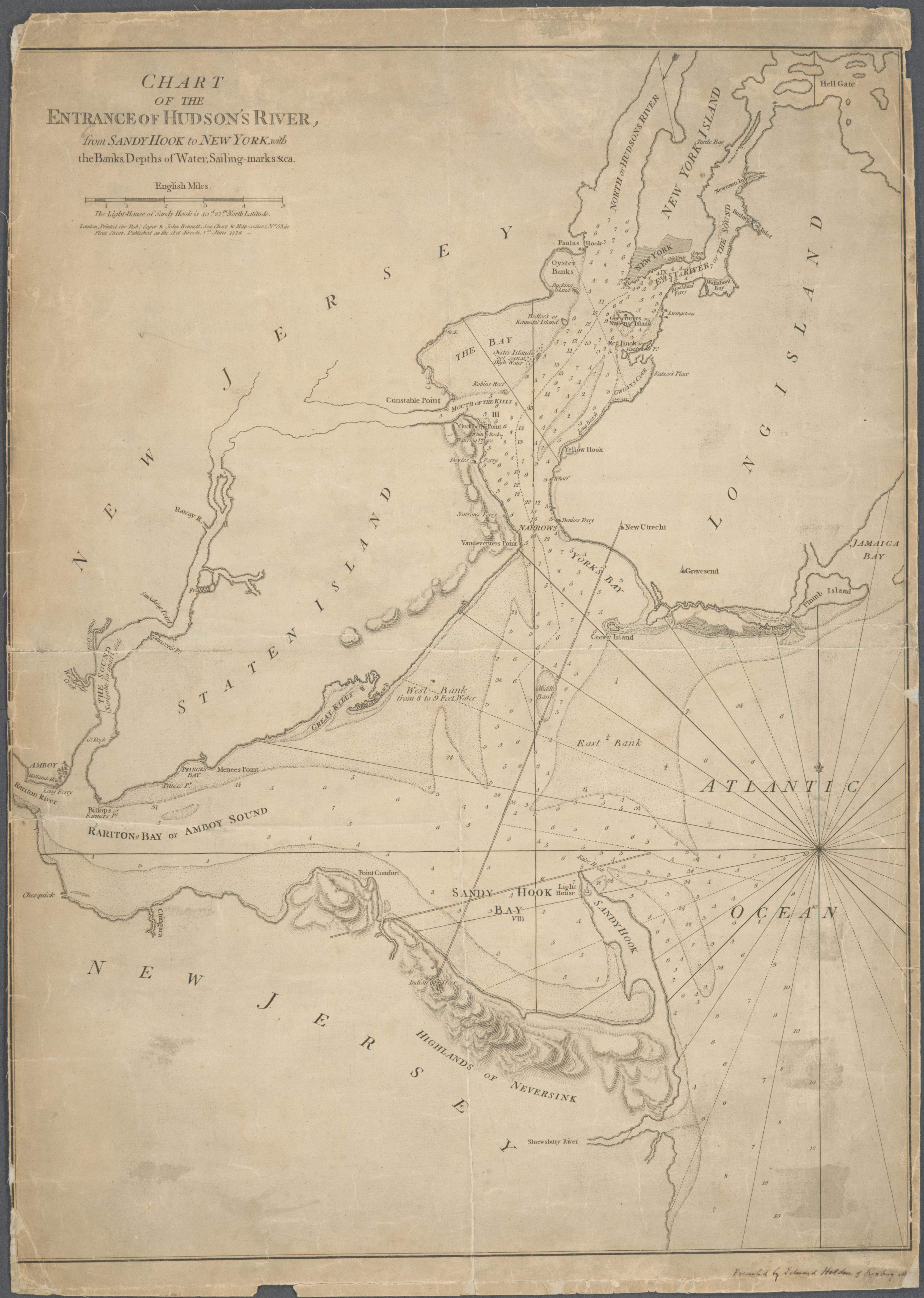
Chart of the Entrance of Hudson's River, from Sandy Hook to New York, 1778
1778
Hudson's River entrance from Sandy Hook to New York (general area)
Printed for Robert Sayer and John Bennett, sea-chart and map-sellers of Fleet Street, London, and published on 1 June 1778 while the Royal Navy still held the harbor. The chart takes in New York, the Kills, Staten Island, Sandy Hook, the Highlands of Neversink, and the Shrewsbury River. The compass rays fan out from a point off the Middle Ground; the banks and channels are labelled with soundings in English feet; the Sandy Hook Lighthouse is marked on the tip. Reads as one of the earliest published English charts to name the Highlands of Neversink as a place on the map.
Item record
- Title
- Chart of the Entrance of Hudson's River, from Sandy Hook to New York, 1778
- Date
- 1778
- Source
- Printed for Robert Sayer and John Bennett, London · 1 June 1778 · scan from the New York Public Library
- Contributor
- The New York Public Library
- Rights
- Public domain (published 1778)
- Slug
sayer-bennett-hudson-entrance-1778
Verification: unverified.
Cite this item
Chart of the Entrance of Hudson's River, from Sandy Hook to New York, 1778 (1778). Printed for Robert Sayer and John Bennett, London · 1 June 1778 · scan from the New York Public Library The Highlands History Project, https://history.abovethehook.com/archive/sayer-bennett-hudson-entrance-1778/.