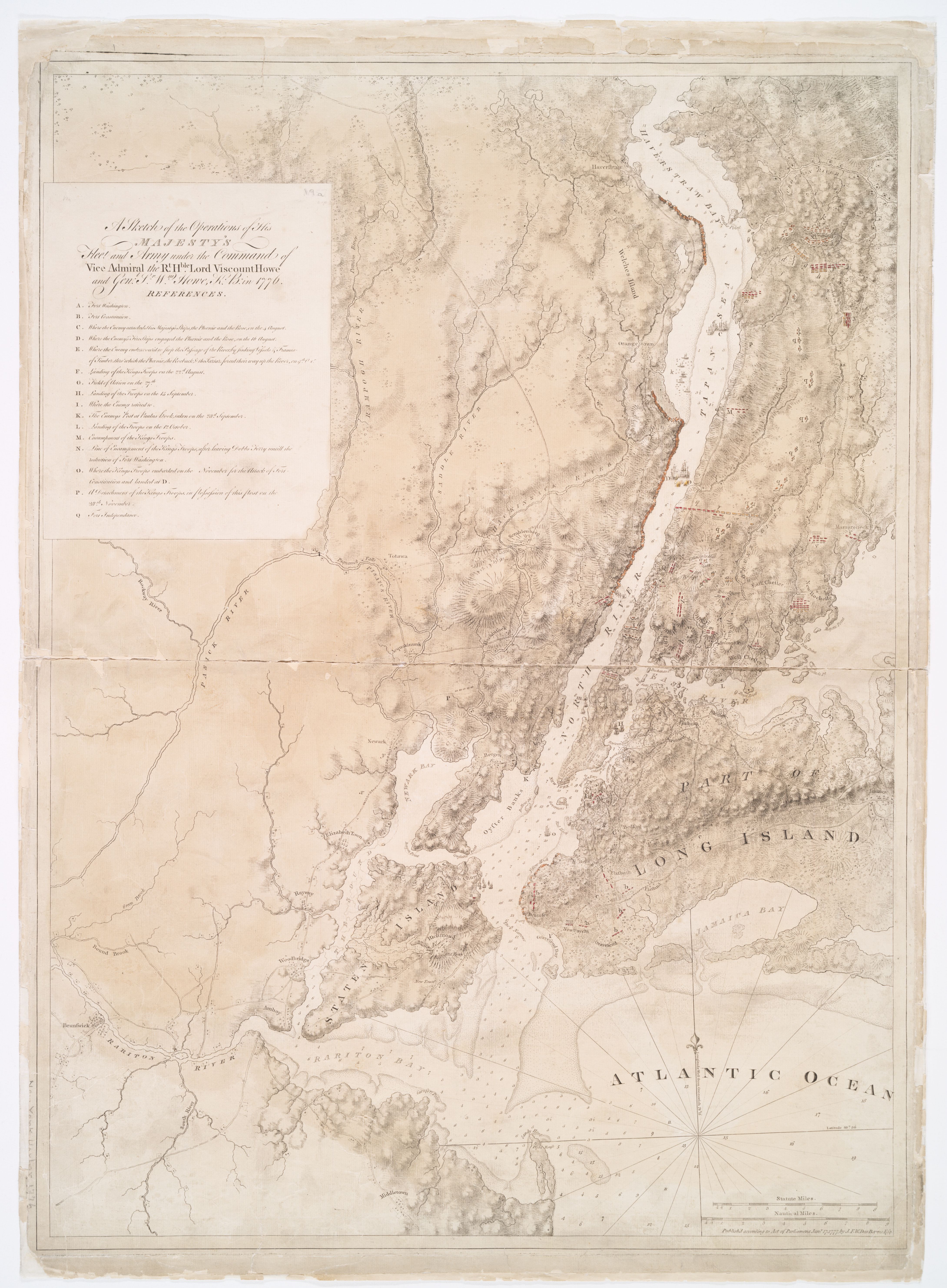
A Sketch of the Operations of His Majesty's Fleet and Army under the Command of Viscount and General Howe, 1776
1777
New York Bay, Manhattan, and the Hudson to Haverstraw (general area)
A large campaign chart of the New York campaign of 1776, drawn up the following year for the Admiralty and published in the Atlantic Neptune by Joseph F. W. Des Barres. The A–Q reference key names each fleet movement, engagement, and encampment: from the July landing at Sandy Hook to Fort Washington in November. The chart-face runs from the Raritan River in the south-west to Haverstraw Bay in the north; the ships of the King's fleet stand in the Hudson in red ink. Sandy Hook at the bottom center is the door through which the British fleet entered the war.
Item record
- Title
- A Sketch of the Operations of His Majesty's Fleet and Army under the Command of Viscount and General Howe, 1776
- Date
- 1777
- Source
- Joseph F. W. Des Barres · from the Atlantic Neptune · published 17 January 1777 · scan from the New York Public Library
- Contributor
- The New York Public Library
- Rights
- Public domain (published 1777)
- Slug
des-barres-howe-operations-1777
Verification: unverified.
Cite this item
A Sketch of the Operations of His Majesty's Fleet and Army under the Command of Viscount and General Howe, 1776 (1777). Joseph F. W. Des Barres · from the Atlantic Neptune · published 17 January 1777 · scan from the New York Public Library The Highlands History Project, https://history.abovethehook.com/archive/des-barres-howe-operations-1777/.