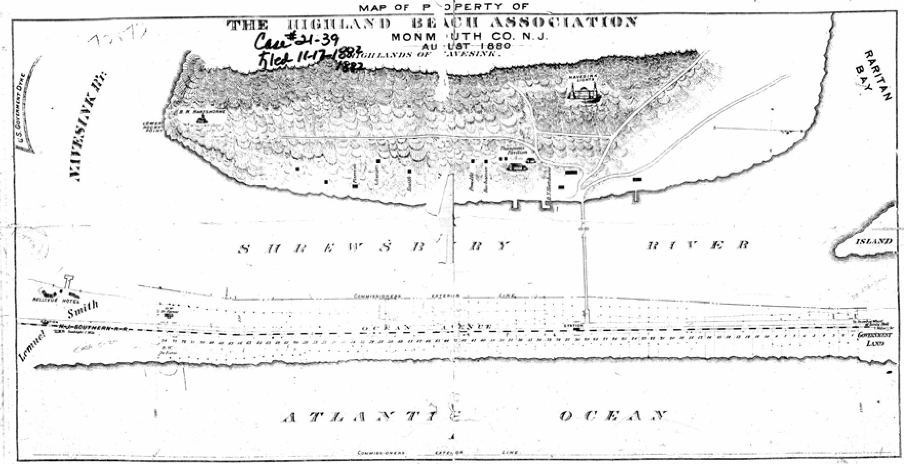
Map of Property of the Highland Beach Association, August 1880
1880
Highland Beach, foot of Sandy Hook (general area)
The surveyed plan of the tract, drawn in August 1880 — six months before Anthony and Mary Reckless sold it. The sheet is titled MAP OF PROPERTY OF THE HIGHLAND BEACH ASSOCIATION, MONMOUTH CO. N.J., AUGUST 1880, HIGHLANDS OF NAVESINK, and shows the Navesink Highlands ridge across the top with the lighthouse marked, the Shrewsbury River through the middle, and the barrier strip below it carrying Ocean Avenue, the N.J. Southern R.R. and the numbered building lots, with GOVERNMENT LAND marked off at the right-hand end. A clerk's hand across the top reads Case #21-39, Filed 11-17-1887 — the sheet was entered as an exhibit seven years after it was drawn. Figure 20 of the NPS Highland Beach research paper (McCollough and Rasa, 2005).
Item record
- Title
- Map of Property of the Highland Beach Association, August 1880
- Date
- 1880
- Source
- Gateway NRA Museum Collection · via the NPS Highland Beach research paper, 2005
- Contributor
- Gateway National Recreation Area Museum Collection
- Rights
- Public domain — map surveyed and drawn in 1880.
- Slug
hb-nps-association-map-1880
Verification: unverified.
Cite this item
Map of Property of the Highland Beach Association, August 1880 (1880). Gateway NRA Museum Collection · via the NPS Highland Beach research paper, 2005 The Highlands History Project, https://history.abovethehook.com/archive/hb-nps-association-map-1880/.