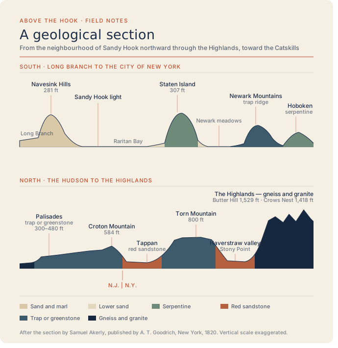
A Geological Section from Sandy Hook to the Catskill Mountains, 1820
1820
Sandy Hook to the Catskills · northern New Jersey to New York (approximate)
Samuel Akerly's 1820 cross-section — read before the Lyceum of Natural History of New York in August 1819 and published the next year by A. T. Goodrich & Co. of Broadway, Nassau, New York — redrawn in the Above the Hook brand system. Runs from Long Branch and the Neversink Hills, across Raritan Bay, over successive "trap or greenstone" ranges, and ends in the granite and gneiss of the Highlands.
Item record
- Title
- A Geological Section from Sandy Hook to the Catskill Mountains, 1820
- Date
- 1820
- Source
- Redrawn by Above the Hook after Samuel Akerly · published by A. T. Goodrich & Co., New York · 1820
- Contributor
- The New York Public Library
- Rights
- Public domain (published 1820)
- Slug
maps-geological-section-akerly-1820
Verification: unverified.
Cite this item
A Geological Section from Sandy Hook to the Catskill Mountains, 1820 (1820). Redrawn by Above the Hook after Samuel Akerly · published by A. T. Goodrich & Co., New York · 1820 The Highlands History Project, https://history.abovethehook.com/archive/maps-geological-section-akerly-1820/.