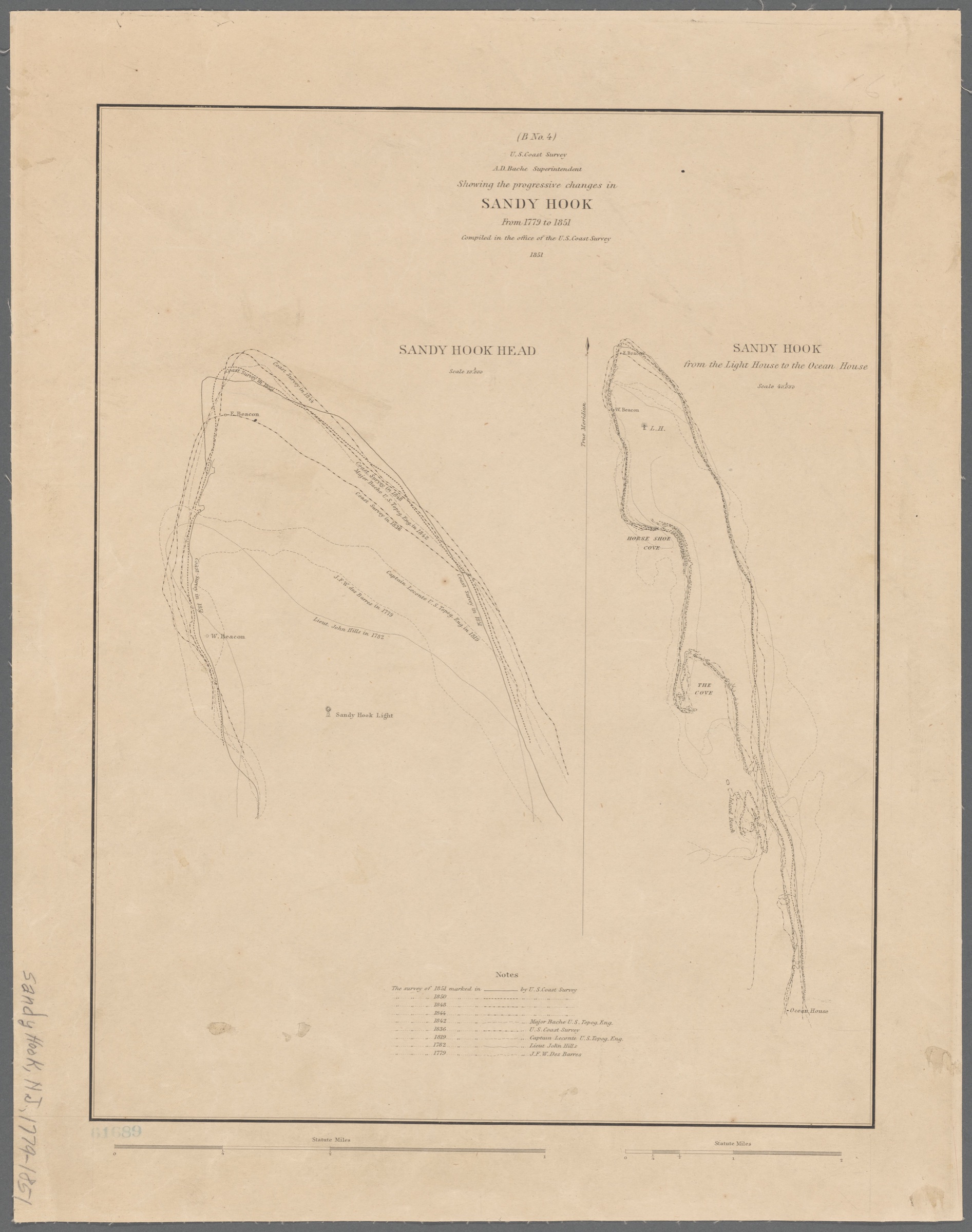
Showing the progressive changes in Sandy Hook from 1779 to 1851
1851
Sandy Hook peninsula · Head and southern reach (general area)
The chart-morph as a single document. Compiled in the office of the U.S. Coast Survey under A. D. Bache, this sheet overlays nine surveys of Sandy Hook's tip across seventy-two years — Des Barres in 1779, John Hills in 1782, Lecomte in 1819, the Coast Survey in 1836, 1842, 1844, 1848, 1850, and 1851 — against the fixed 1764 Sandy Hook Lighthouse. The tip walks north. Left panel: Sandy Hook Head at 1:10,000. Right panel: Sandy Hook from the Light House to the Ocean House at 1:40,000. The only nineteenth-century image that makes the growth of the spit legible in one glance.
Item record
- Title
- Showing the progressive changes in Sandy Hook from 1779 to 1851
- Date
- 1851
- Source
- A. D. Bache, Superintendent · U.S. Coast Survey · Washington, D.C. · 1851 · scan from the New York Public Library, Lionel Pincus and Princess Firyal Map Division
- Contributor
- The New York Public Library · Lionel Pincus and Princess Firyal Map Division
- Rights
- Public domain in the United States (federal government publication)
- Slug
progressive-changes-1851
Verification: unverified.
Cite this item
Showing the progressive changes in Sandy Hook from 1779 to 1851 (1851). A. D. Bache, Superintendent · U.S. Coast Survey · Washington, D.C. · 1851 · scan from the New York Public Library, Lionel Pincus and Princess Firyal Map Division The Highlands History Project, https://history.abovethehook.com/archive/progressive-changes-1851/.